Neon and Choprock Canyons
May 14, 2016
I finally descended Neon and Choprock canyons.
The weather forecast was ideal, temperatures great, and the canyons were probably full. My friends who were doing the canyon with me were all in shape. Everything was lining up perfectly. At least until I started throwing up at the trailhead. This was going to be a memorable trip.
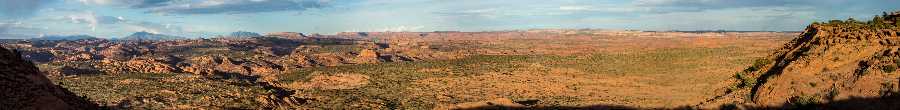
Our plan was to drive down and camp at the Egypt trailhead. Friday we would backpack down to the Escalante, descend Neon, and camp near Choprock. Saturday we would descend Choprock. Sunday we would pack up, head back to the trailhead and go home. Our crew consisted of four canyoneers. Two of them had done Neon and one Choprock. This would be my first time for both.
Last time I had thrown up was in Quandary, shortly before the direct section, where I filled a small pothole with my vomit. The canyon had been completely dry up until that point. That was a rough day.
This time was different, though: I had a full day to recover before the big canyon. If I was lucky, I could recover and not be a liability come Saturday. If I was a liability, I was out. Choprock is such a long and arduous day and the line between success and disaster is so thin that I couldn’t put it on my crew to take me through there when I wasn’t at 100% capacity.
I awoke the following morning feeling pretty terrible. My biggest concern was that I didn’t want to be a burden on anybody. We were on vacation after all. After a light breakfast and some moseying around I felt well enough to at least backpack with everyone down to the river. If I continued feeling better maybe I could do Neon with them.
We started hiking down and I started feeling better – a lot better, actually. Well enough that I agreed to let them take me through Neon.
Neon
On the approach hike, we saw another group of canyoneers dropping in. Not wanting to butt up against them if we caught up to them, we decided to explore up canyon a half mile. For those of you wondering what is up there, it’s more beautiful canyon. It doesn’t have the high walls so it’s more exposed to the sun, but it was beautiful nonetheless. It added a couple of rappels, pools, and down climbs.
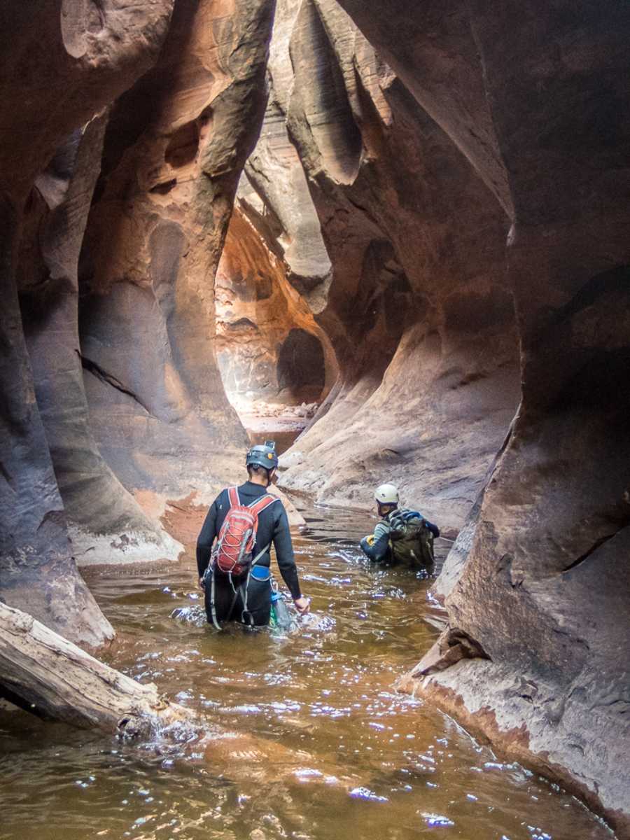
The canyon was completely full – full enough that the keeper potholes would not have been found without people pointing out where they were, several feet below the water.
We caught up with several groups shortly before the big keeper pothole and chose to continue on through the final rappel so that we wouldn’t be stuck waiting at the end.
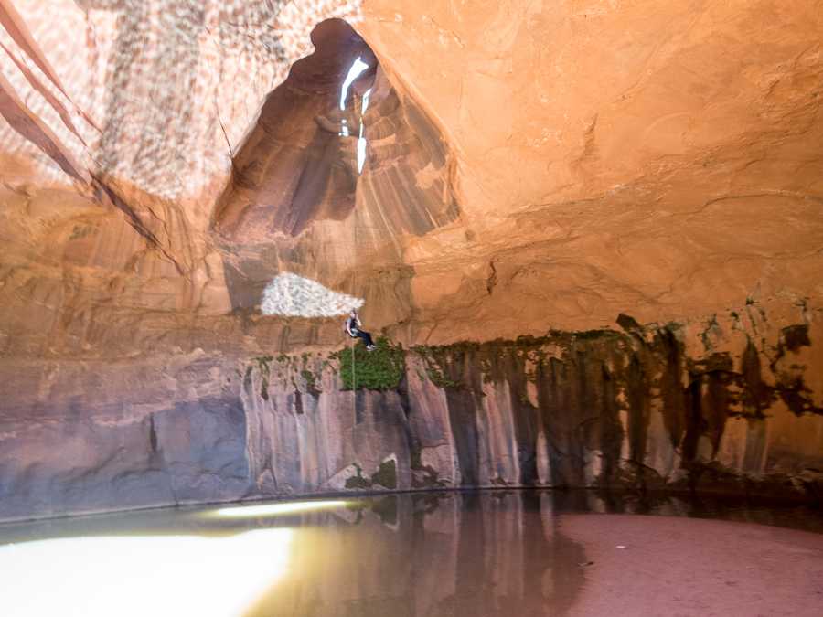
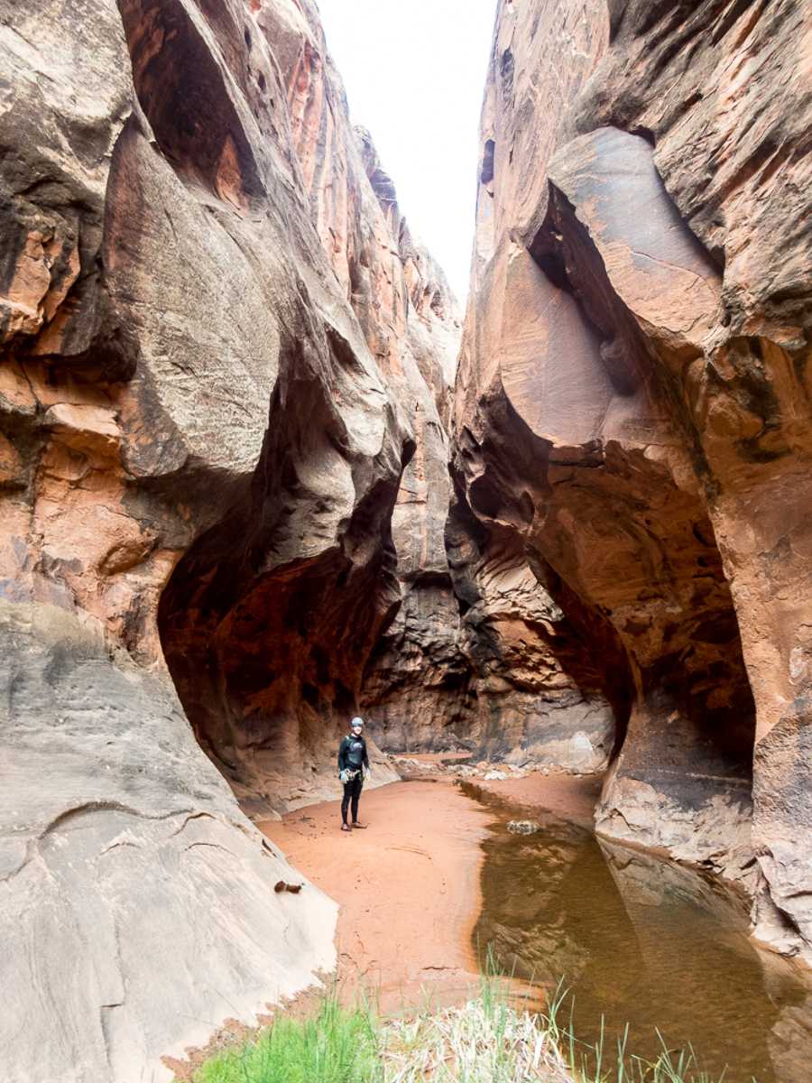
The Golden Cathedral rappel is one of the most beautiful rappels ever. It goes through a blown out pothole into a shallow pool. There are two other holes beyond the rappel one that you can look up into.
Unfortunately, I had seen so many pictures of the Golden Cathedral that it didn’t impact me as much as it could have had I never seen any pictures of it.
After finishing the rappels we ate lunch, watched the subsequent groups rappel, and took a short nap while our wetsuits dried in the sun. That grotto is a great place to have lunch and relax. After an hour and a half, the final group still hadn’t finished rappelling (they were filming themselves so it was taking forever). I’m glad we pushed through before them.
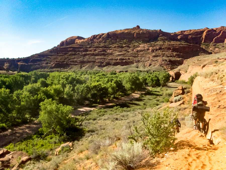
We hiked the short distance up closer toward Choprock and set up camp, had dinner, pumped water, and played in the river.
Choprock
We set alarms for 5:20 am with plans to leave at 5:30 but ended up leaving closer to 6:00. It was a cold morning and leaving the jackets behind was a difficult choice.
Choprock is quite different from its Neon neighbor. It is very long and very skinny. Very long canyons usually mean more food, extra clothes for warmth, and more gear. Because it’s so skinny, you can’t bring anything you don’t absolutely need. I brought a Leprechaun backpack and put in 2 liters of water, some food, a small amount ofwebbing, and VT Prusiks. I rolled my 4/3 wetsuit up, wrapped it with some accessory cord, and clipped it to my pack with my spare biners. My helmet was clipped to the back, and I carried the rope on the approach. We also included a water filter in the group gear just in case. Though it was cold in the morning, leaving the jackets was a great idea. Within half an hour our bodies were warmed up from the walking and within an hour the sun was up.
The approach is quite long at 6 miles. However, the uphill was gentle aside from a few short parts. This was the second time we had plans to do Choprock and I had really studied the approach well so I never had to pull out the GPS. The only things I would add to others’ beta would be the following:
- Find how to get up the lowest cliff the night before if possible. People have gotten lost there before. It added hours to their time and they ended up exiting in the dark. For the first cliff, you should be able to do it without using your hands, or using them just a little. If it looks any more difficult than than, you are in the wrong spot.
- When you make to the the second plateau and are wrapping around the north side, go down, down, down. Go as far down as you can and keep going down as you work your way up canyon.
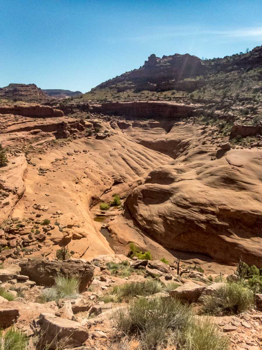
We made it to the bottom of the canyon at 8:30, had snacks, and put on wetsuits. The member of our group who had done Choprock before said the whole area was dry the last time he went though. It worried us that we might not be able to swim under the grim section obstacles, making our descent much more difficult. We started again at 9:00.
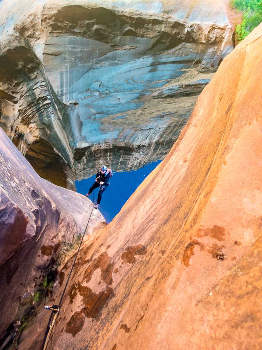
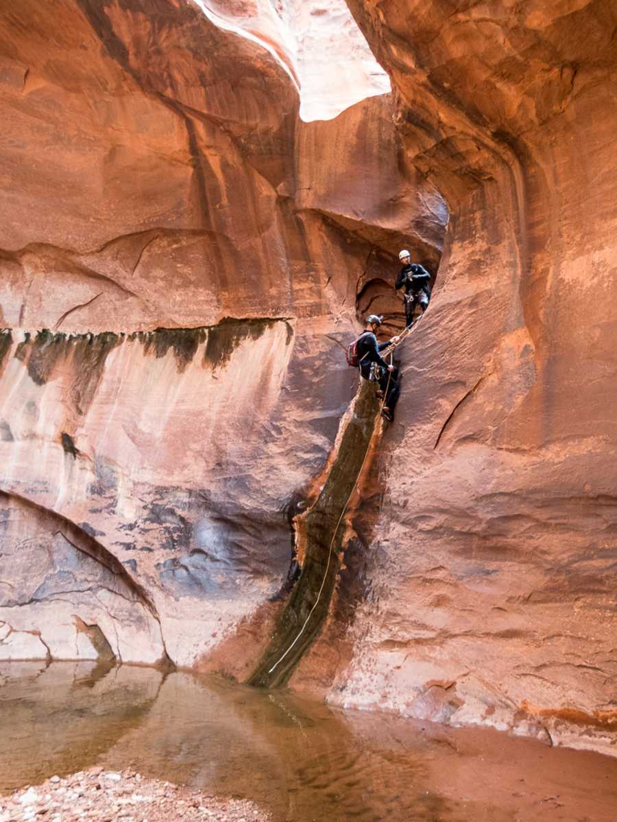
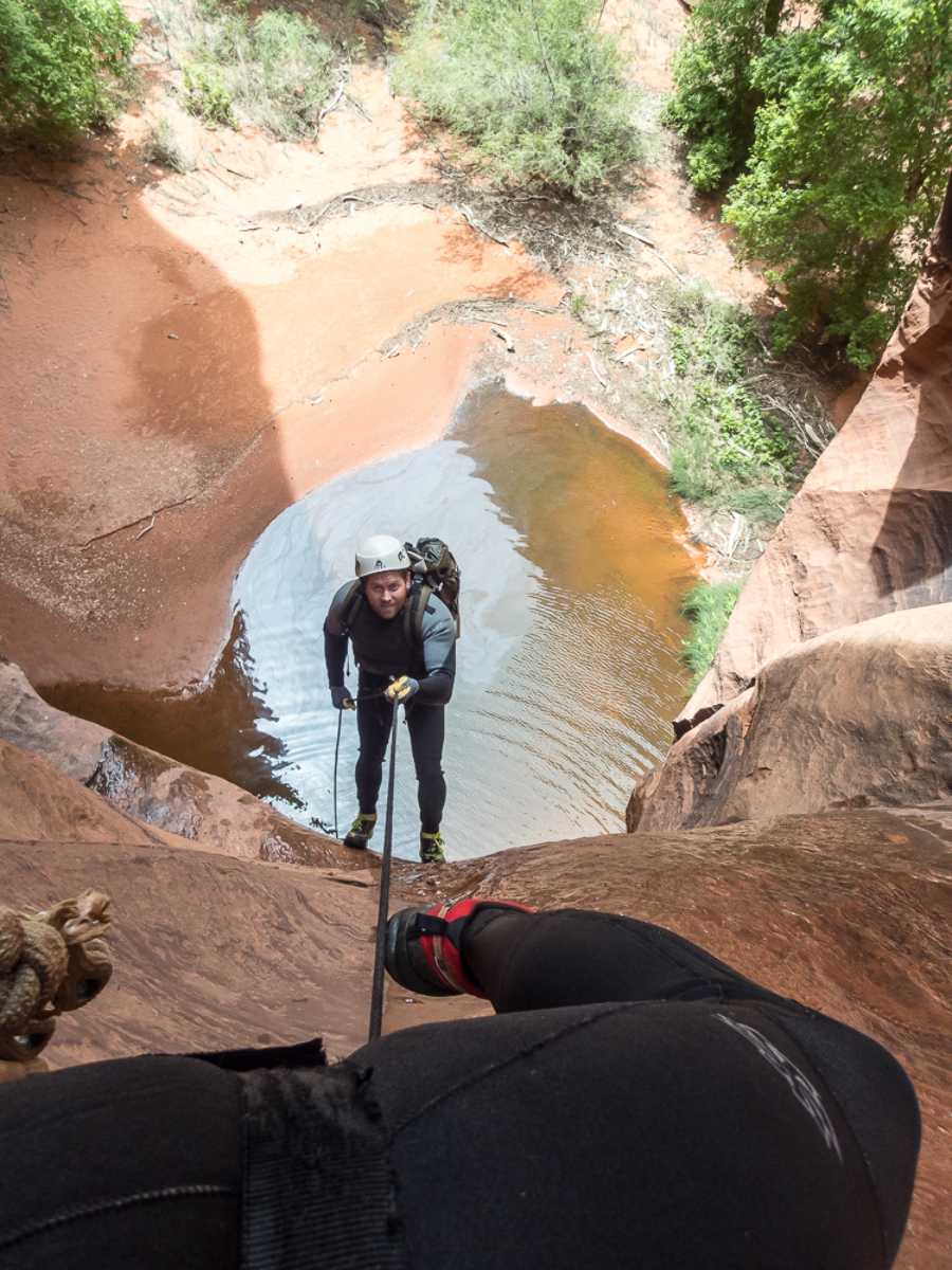
Getting to the Riparian section consisted of difficult down climbs – standard for Escalante. That first rappel is incredible enough that I won’t spoil it here with a crappy description.
I wasn’t particularly impressed with the Riparian section. If you have been through Kolob, it’s a lot like hiking the first few miles after the big rappel in the creek. Slippery rocks, lots of mud mixed with vegetation make it slow going whether you follow the water course or try to hike around it.
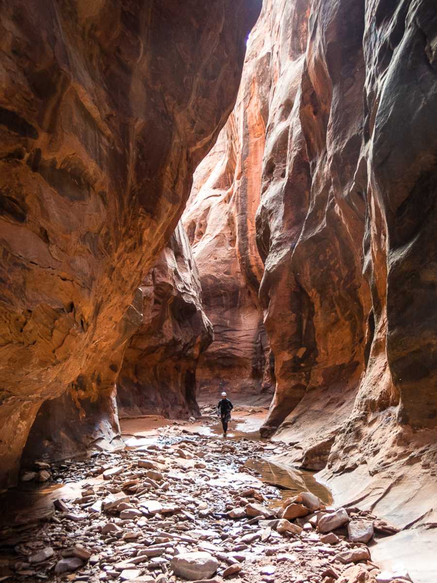
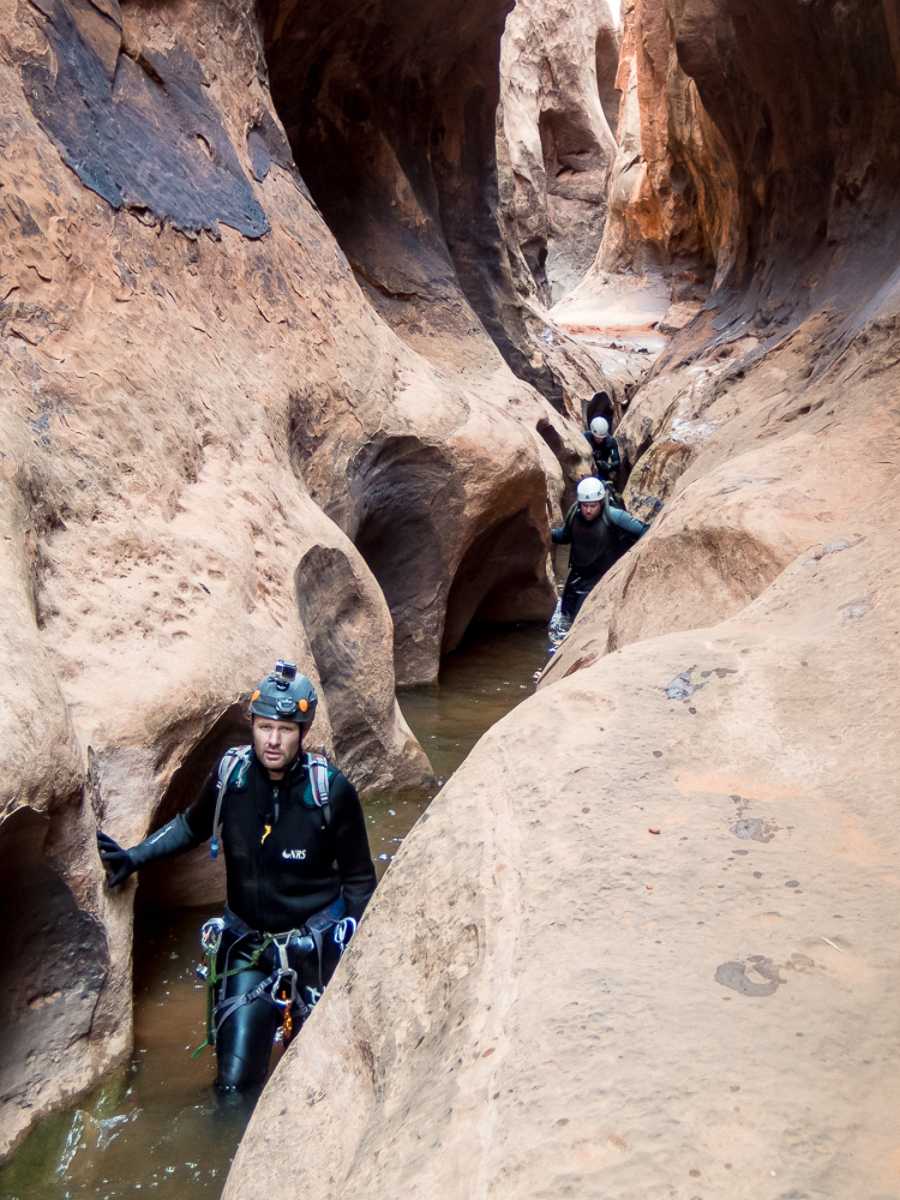
The Riparian section ended abruptly as the walls closed in and the vegetation ended. I proudly announced that we were transitioning to the Happy section at 10:15.
What can I say about the happy section? It’s beautiful. If Choprock ended in the happy section, it might be more popular than Neon. It certainly is more scenic.
As soon as the water stopped flowing, we knew we were entering the Grim section. We stopped to pump water and eat lunch in the last remaining light – just a sliver creeping across the floor and up the wall. We were stopped long enough that I was starting to get chilled. Not good. We started again at 11:30.
We had seen footprints at the beginning of the canyon. However, there were several parts in the Grim section where we had to push and climb over debris to get through. I can’t imagine someone had gone through there without having done that already.
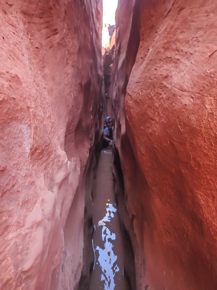
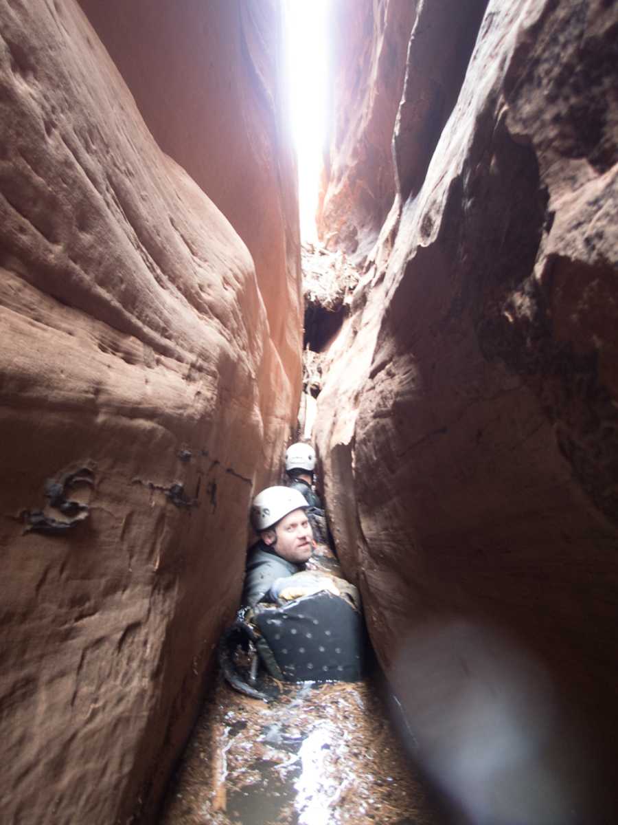
Just as I was starting to warm up again, we reached the spot. Thirty feet high easily. Very intimidating. I wasn’t cold anymore, but was feeling chilled knowing what this place was and its history. We were swimming at that point, pushing logs and debris forward trying to get through.
The person in front had to stop and told us that it was no longer possible to push the debris forward. There was just too much and the walls were too skinny. He couldn’t climb over it, either. Our only solution was to chimney up and push the debris under and behind us. We were then able to go back down and continue on.
We were lucky, though. There was a one or two foot gap between the water and the debris wall that we could swim under. Swimming under the debris is less strenuous, but no less dangerous. In subsequent debris walls where the water had been less disturbed by passage, there were small piles of sticks and junk right under the debris walls. The debris had the potential to collapse at any moment. It reminded me of that game where you put a bunch of sticks into a cylinder and then put a bunch or marbles on top. As we take turns removing sticks, more and more marbles fall through. Eventually there is a stick removed that sends all the marbles plunging down.
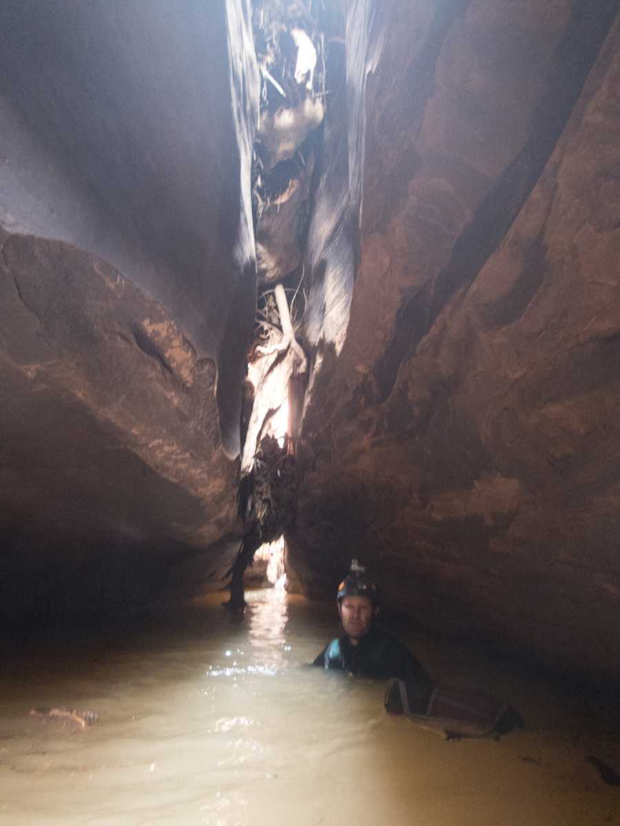
Many of the debris walls had large logs sticking down into the water below. We took extra care not to touch these as we quickly swam underneath. Also, we only sent one person through at a time.
There are other cool things about the Grim section that I won’t spoil here.
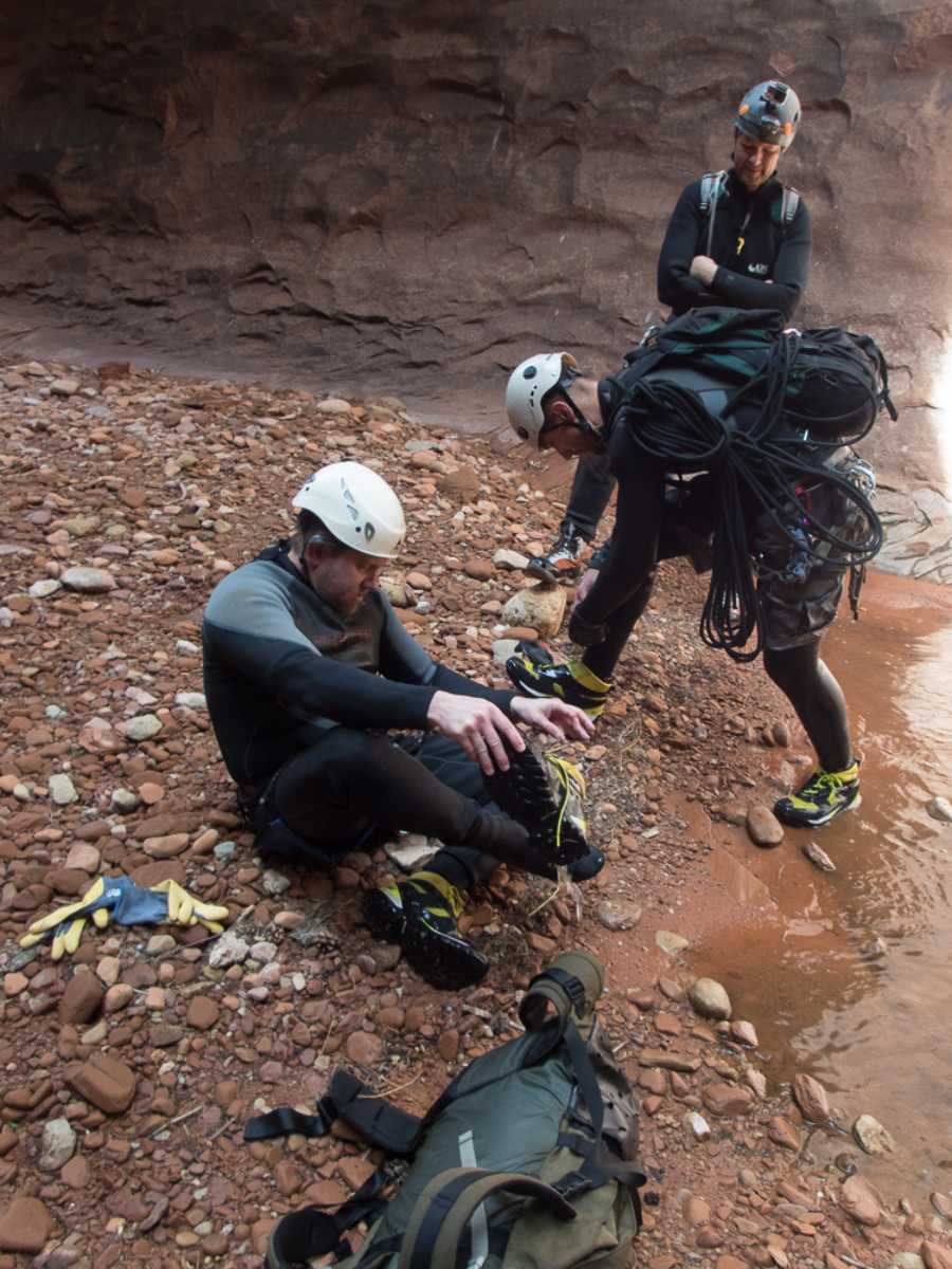
We finished the last rappel at 2:30, suited down, took a break, and started heading back to our campsite at 3:00. An hour later we arrived and decided we would have time to pack up and hike back to the Egypt trailhead that same day instead of camping another night. We took an hour to pack everything back up and left for Fence Canyon at 5:00.
The hike out Fence was uneventful except for the last 500′ of elevation and 1/4 mile hiking. We had full packs with sleeping bags, stoves, etc. I think we were going on mile 14 and 2000 foot elevation gain, plus a mile of swimming, half a mile of down climbing, and 170 feet of rappelling. Some of us started hitting our wall and we took that last steep section slowly.
We arrived at the cars at 7:45, drove to Escalante and had dinner, and drove home, getting back at 2:30 am. That Sunday I got hit with my kidney disease and was wiped out for the next week.
All in all I considered a successful trip. Everything went right, we were safe and efficient. I can’t wait to visit again.